Solan
Solan is a city in the Indian state of Himachal Pradesh and the district headquarters of Solan district. It is located 45.5 km south of the state capital, Shimla. Solan has an average elevation of 1550 m. The city is situated between Chandigarh (joint capital of Punjab and Haryana) and Shimla (state capital) on the Kalka-Shimla National Highway-5. The narrow-gauge Kalka-Shimla railway passes through Solan. Located on the Punjab-Himachal Border, Solan is nestled in the Shivalik hills of the Himalayas.
Solan was originally the capital of the princely state, Baghat. A defining feature of Solan, is its ancient temples and monasteries. The Shoolini Mata Temple and Jatoli Shiv Temple are popular attractions for tourists. One of the most famous monasteries in this region is the Yundung Monastery. The hill-town is named after the Hindu goddess Shoolini Devi ~ who is a manifestation of Goddess Durga in Her warrior aspect. Shoolini, when translated literally, means 'the goddess wielding the spear'. Every year in June, a fair venerating the Goddess is held, featuring a 3-day melā at the central Thodo ground.
Solan is known for the production of quality mushrooms, as a result of the vast mushroom farming in the area, as well as the Directorate of Mushroom Research (DMR) situated at Chambaghat. Due to this fact, Solan is also known as the "Mushroom City of India". Solan is also called the "City of Red Gold", due to the bulk production of tomatoes in the area.
The city has one of the oldest breweries in the country, and also has a 300-year-old fort located at the top of a hill.
The history of Solan goes back to the era of Pandavas. According to local folklore, Pandavas lived here during their exile. In 1815, British won Baghat state (now Solan) from the Gurkhas. Gurkha fort, or Arki Fort, is still standing tall on a mountain near to the city of Solan, and it is one of the historic tourist attractions of Solan. The town has been a capital of the princely Baghat State. The word Baghat is derived from Bau, or Bahu, meaning "many", and Ghat, meaning "pass". Initially, the state headquarters of the Baghat State was located at Bhoch in the Bhuchali pargana. The headquarters of the state was shifted to Solan, after the construction of cantonment in the city; the railway was set up in 1902. The evolution of Solan city can be understood in the following order or sequence:
* Establishment of a cantonment area at Solan by Brits.
* Establishing a brewery in Solan in 1855, due to availability of excellent quality mineral water.
* Shifting of the headquarters of Baghat State from Bhoch to Solan.
* Start of Kalka-Shimla rail line in 1902.
* Start of transportation activity on Kalka-Solan-Shimla road.
Map - Solan
Map


Country - India
 |
 |
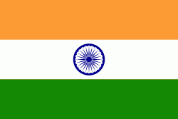
| Flag of India | |
Modern humans arrived on the Indian subcontinent from Africa no later than 55,000 years ago. Their long occupation, initially in varying forms of isolation as hunter-gatherers, has made the region highly diverse, second only to Africa in human genetic diversity. Settled life emerged on the subcontinent in the western margins of the Indus river basin 9,000 years ago, evolving gradually into the Indus Valley Civilisation of the third millennium BCE. By, an archaic form of Sanskrit, an Indo-European language, had diffused into India from the northwest. (a) (b) (c), "In Punjab, a dry region with grasslands watered by five rivers (hence ‘panch’ and ‘ab’) draining the western Himalayas, one prehistoric culture left no material remains, but some of its ritual texts were preserved orally over the millennia. The culture is called Aryan, and evidence in its texts indicates that it spread slowly south-east, following the course of the Yamuna and Ganga Rivers. Its elite called itself Arya (pure) and distinguished themselves sharply from others. Aryans led kin groups organized as nomadic horse-herding tribes. Their ritual texts are called Vedas, composed in Sanskrit. Vedic Sanskrit is recorded only in hymns that were part of Vedic rituals to Aryan gods. To be Aryan apparently meant to belong to the elite among pastoral tribes. Texts that record Aryan culture are not precisely datable, but they seem to begin around 1200 BCE with four collections of Vedic hymns (Rg, Sama, Yajur, and Artharva)."
Currency / Language
| ISO | Currency | Symbol | Significant figures |
|---|---|---|---|
| INR | Indian rupee | ₹ | 2 |
| ISO | Language |
|---|---|
| AS | Assamese language |
| BN | Bengali language |
| BH | Bihari languages |
| EN | English language |
| GU | Gujarati language |
| HI | Hindi |
| KN | Kannada language |
| ML | Malayalam language |
| MR | Marathi language |
| OR | Oriya language |
| PA | Panjabi language |
| TA | Tamil language |
| TE | Telugu language |
| UR | Urdu |